Акс:Ancient Greek Colonies of N Black Sea.png
Андозаи ин пешнамоиш: 800 × 500 пиксел. Дигар кайфиятҳо: 320 × 200 пиксел | 640 × 400 пиксел | 1 024 × 640 пиксел | 1 289 × 806 пиксел.
Акси аслӣ ((1 289 × 806 пиксел, ҳаҷми парванда: 294 кбайт, навъи MIME: image/png))
Хулоса
| Тавсифот |
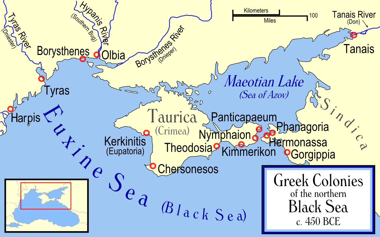
English: Map showing Ancient Greek colonies on the northern coast of the Black Sea. |
| Манбаъ | No machine-readable source provided. Own work assumed (based on copyright claims). |
| Муаллиф | No machine-readable author provided. MapMaster assumed (based on copyright claims). |
Иҷозатнома
I, the copyright holder of this work, hereby publish it under the following licenses:

|
Permission is granted to copy, distribute and/or modify this document under the terms of the GNU Free Documentation License, Version 1.2 or any later version published by the Free Software Foundation; with no Invariant Sections, no Front-Cover Texts, and no Back-Cover Texts. A copy of the license is included in the section entitled GNU Free Documentation License. |
| This file is licensed under the Creative Commons Attribution-Share Alike 3.0 Unported license. | ||
| ||
| This licensing tag was added to this file as part of the GFDL licensing update. |
Шумо иҷозатномаи хостаи худро интихоб карда метавонед.

|
File:Map ancient Greek colonies in northern Black Sea-en.svg is a vector version of this file. It should be used in place of this PNG file when not inferior.
File:Ancient Greek Colonies of N Black Sea.png → File:Map ancient Greek colonies in northern Black Sea-en.svg
For more information, see Help:SVG. |
 |
Таърихи файл
Рӯи таърихҳо клик кунед то нусхаи марбути парвандаро бубинед.
| Таърих | Бандангуштӣ | Андоза | Корбар | Тавзеҳ | |
|---|---|---|---|---|---|
| нусхаи феълӣ | 10:37, 25 марти 2014 | | 1 289 × 806 (294 кбайт) | Spiridon Ion Cepleanu | Little changes (ancient shoreline & Harpis colony) according with V. Yanko-Hombach, A.S. Gilbert, N. Panin, P. M. Dolukhanov: ''The Black Sea Flood Question: Changes in Coastline, Climate, and Human Settlement'', Springer, Netherlands, 2007. |
| 21:26, 2 марти 2014 |  | 1 289 × 806 (264 кбайт) | Ras67 | cropped, opt. | |
| 18:54, 14 Декабри 2006 |  | 1 301 × 818 (324 кбайт) | MapMaster | December 6 upload still showed earlier version on all pages. Reduced resolution a bit and am trying again | |
| 04:10, 6 Декабри 2006 |  | 1 409 × 886 (361 кбайт) | MapMaster | Changed name of a colony | |
| 03:52, 29 ноябри 2006 |  | 1 409 × 886 (362 кбайт) | MapMaster | Numerous changes based on numerous feedback. | |
| 05:03, 28 ноябри 2006 |  | 1 626 × 1 023 (415 кбайт) | MapMaster | Map showing Ancient Greek colonies on the northern coast of the Black Sea. |
Пайвандҳо
Саҳифаҳои зерин ба ин акс пайванданд:
Истифодаи саросарии парванда
Викиҳои дигари зерин ин файлро истифода мекунанд:
- Истифода дар am.wikipedia.org
- Истифода дар an.wikipedia.org
- Истифода дар ar.wikipedia.org
- Истифода дар bg.wikipedia.org
- Истифода дар bs.wikipedia.org
- Истифода дар ca.wikipedia.org
- Истифода дар cs.wikipedia.org
- Истифода дар da.wikipedia.org
- Истифода дар de.wikipedia.org
- Истифода дар en.wikipedia.org
- Истифода дар en.wiktionary.org
- Истифода дар eu.wikipedia.org
- Истифода дар fi.wikipedia.org
- Истифода дар fr.wikipedia.org
- Истифода дар he.wikipedia.org
View more global usage of this file.