Акс:Andijan districts.png

Андозаи ин пешнамоиш: 776 × 600 пиксел. Дигар кайфиятҳо: 311 × 240 пиксел | 621 × 480 пиксел | 994 × 768 пиксел | 1 280 × 989 пиксел | 2 112 × 1 632 пиксел.
Акси аслӣ ((2 112 × 1 632 пиксел, ҳаҷми парванда: 49 кбайт, навъи MIME: image/png))
Хулоса
| Тавсифот |
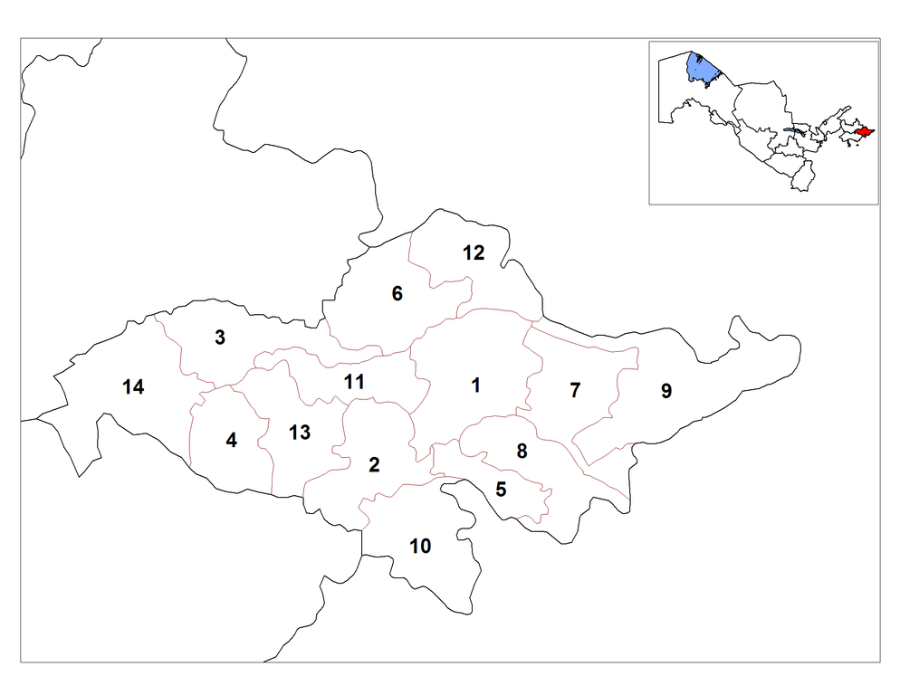
English: Map of the districts (tuman) of the province (viloyat) of Andijan in Uzbekistan. |
| Сана | |
| Манбаъ | Кори худ |
| Муаллиф | Rarelibra |
| Other versions | Derivative works of this file: Andijon districts empty.png |
Иҷозатнома
| I, the copyright holder of this work, release this work into the public domain. This applies worldwide. In some countries this may not be legally possible; if so: I grant anyone the right to use this work for any purpose, without any conditions, unless such conditions are required by law. |
Таърихи файл
Рӯи таърихҳо клик кунед то нусхаи марбути парвандаро бубинед.
| Таърих | Бандангуштӣ | Андоза | Корбар | Тавзеҳ | |
|---|---|---|---|---|---|
| нусхаи феълӣ | 14:51, 28 октябри 2008 | | 2 112 × 1 632 (49 кбайт) | Man77 | == Summary == {{Information |Description={{en|1=Map of the districts (tuman) of the province (viloyat) of Andijan in Uzbekistan.}} |Source=Own work by uploader |Author=Rarelibra |Date=10/20/2008 |Permission= |other_versions= }} <!--{{I |
| 17:53, 20 октябри 2008 |  | 2 112 × 1 632 (51 кбайт) | Rarelibra | {{Information |Description={{en|1=Map of the districts (tuman) of the province (viloyat) of Andijan in Uzbekistan.}} |Source=Own work by uploader |Author=Rarelibra |Date=10/20/2008 |Permission= |other_versions= }} <!--{{ImageUpload|ful |
Пайвандҳо
Саҳифаҳои зерин ба ин акс пайванданд:
Истифодаи саросарии парванда
Викиҳои дигари зерин ин файлро истифода мекунанд:
- Истифода дар ar.wikipedia.org
- Истифода дар bg.wikipedia.org
- Истифода дар bn.wikipedia.org
- Истифода дар de.wikipedia.org
- Истифода дар en.wikipedia.org
- Истифода дар es.wikipedia.org
- Истифода дар fa.wikipedia.org
- Истифода дар fr.wikipedia.org
- Истифода дар id.wikipedia.org
- Истифода дар incubator.wikimedia.org
- Истифода дар it.wikipedia.org
- Regione di Andijan
- Distretti dell'Uzbekistan
- Distretto di Andijan
- Distretto di Boz
- Distretto di Jalalkuduk
- Distretto di Khodjaobod
- Distretto di Kurgontepa
- Distretto di Oltinkol
- Distretto di Pakhtaabad
- Distretto di Ulygnor
- Distretto di Asaka
- Distretto di Baliqchi
- Distretto di Buloqboshi
- Distretto di Izboskan
- Distretto di Marhamat
- Истифода дар ja.wikipedia.org
- Истифода дар jv.wikipedia.org
- Истифода дар kk.wikipedia.org
- Истифода дар ky.wikipedia.org
- Истифода дар lt.wikipedia.org
- Истифода дар ms.wikipedia.org
- Истифода дар pa.wikipedia.org
- Истифода дар ps.wikipedia.org
- Истифода дар ru.wikipedia.org
- Истифода дар ta.wikipedia.org
- Истифода дар tr.wikipedia.org
- Истифода дар tt.wikipedia.org
- Истифода дар ur.wikipedia.org
- Истифода дар uz.wikipedia.org
- Истифода дар zh.wikipedia.org