Акс:Map of the Hyderabad princely state (1909).svg

Ҳаҷми пешнамоиши PNG барои файли кунунии SVG: 683 × 599 пиксел. Дигар кайфиятҳо: 274 × 240 пиксел | 547 × 480 пиксел | 875 × 768 пиксел | 1 167 × 1 024 пиксел | 2 334 × 2 048 пиксел.
Акси аслӣ (SVG парванда, исмӣ 800 × 702 пиксел, андозаи парванда: 27 кбайт)
Хулоса
| Тавсифот |
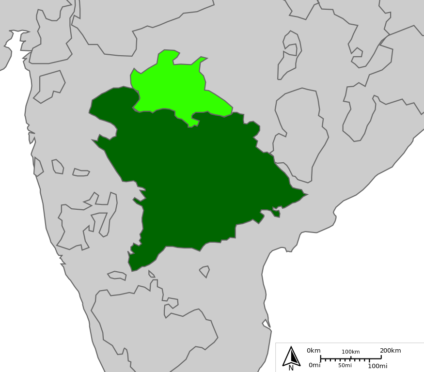
English: Map of Indian state of Hyderabad in 1909
Legend:
|
| Сана | |
| Манбаъ |
http://sharemap.org/public/Hyderabad Geospatial data sources:
|
| Муаллиф | Jkan997 |
| SVG genesis | This W3C-invalid map was created with ShareMap.org. |


.svg)
Thumbnail with colored legend in caption
.svg)
[[File:Hyderabad princely state 1909.svg|thumb|<center>Map of Indian state of Hyderabad in 1909 {{nowrap|([[ShareMap:public/Hyderabad|interactive version]])}}]]
Иҷозатнома
I, the copyright holder of this work, hereby publish it under the following licenses:
This file is licensed under the Creative Commons Attribution-Share Alike 3.0 Unported license.
- Шумо озодед:
- мубодилот намудан – копӣ, паҳн ва фиристадани асар
- ремикс кардан – татбиқи кор
- Under the following conditions:
- тахсис – You must give appropriate credit, provide a link to the license, and indicate if changes were made. You may do so in any reasonable manner, but not in any way that suggests the licensor endorses you or your use.
- саҳми яксон – If you remix, transform, or build upon the material, you must distribute your contributions under the same or compatible license as the original.

|
Permission is granted to copy, distribute and/or modify this document under the terms of the GNU Free Documentation License, Version 1.2 or any later version published by the Free Software Foundation; with no Invariant Sections, no Front-Cover Texts, and no Back-Cover Texts. A copy of the license is included in the section entitled GNU Free Documentation License. |
Шумо иҷозатномаи хостаи худро интихоб карда метавонед.
Таърихи файл
Рӯи таърихҳо клик кунед то нусхаи марбути парвандаро бубинед.
| Таърих | Бандангуштӣ | Андоза | Корбар | Тавзеҳ | |
|---|---|---|---|---|---|
| нусхаи феълӣ | 12:18, 25 апрели 2012 | | 800 × 702 (27 кбайт) | Jkan997 | removed labels |
| 08:52, 25 апрели 2012 |  | 800 × 702 (28 кбайт) | Jkan997 | {{Information |Description ={{en|1=Map of Indian state of Hyderabad in 1909 Legend: *<span style="color:#646464">━━━</span>Princely states borders *<span style="color:#EEEEEE">━━━</span>Princely states territories *<span style="color:#... |
Пайвандҳо
Саҳифаҳои зерин ба ин акс пайванданд:
Истифодаи саросарии парванда
Викиҳои дигари зерин ин файлро истифода мекунанд:
- Истифода дар ar.wikipedia.org
- Истифода дар az.wikipedia.org
- Истифода дар bn.wikipedia.org
- Истифода дар cs.wikipedia.org
- Истифода дар da.wikipedia.org
- Истифода дар en.wikipedia.org
- Истифода дар es.wikipedia.org
- Истифода дар eu.wikipedia.org
- Истифода дар fa.wikipedia.org
- Истифода дар fi.wikipedia.org
- Истифода дар hu.wikipedia.org
- Истифода дар hy.wikipedia.org
- Истифода дар id.wikipedia.org
- Истифода дар io.wikipedia.org
- Истифода дар it.wikipedia.org
- Истифода дар ja.wikipedia.org
- Истифода дар ko.wikipedia.org
- Истифода дар ml.wikipedia.org
- Истифода дар ms.wikipedia.org
- Истифода дар my.wikipedia.org
- Истифода дар pnb.wikipedia.org
- Истифода дар pt.wikipedia.org
- Истифода дар ru.wikipedia.org
- Истифода дар sd.wikipedia.org
- Истифода дар simple.wikipedia.org
- Истифода дар sv.wikipedia.org
- Истифода дар ta.wikipedia.org
- Истифода дар te.wikipedia.org
- Истифода дар th.wikipedia.org
- Истифода дар tr.wikipedia.org
- Истифода дар ur.wikipedia.org
- Истифода дар uz.wikipedia.org
- Истифода дар vi.wikipedia.org
- Истифода дар www.wikidata.org
- Истифода дар zh.wikipedia.org
.svg)