Акс:Khanate of Talysh in the Map of Caucasus with the borders 1801-1813.png

Khanate_of_Talysh_in_the_Map_of_Caucasus_with_the_borders_1801-1813.png ((488 × 558 пиксел, ҳаҷми парванда: 528 кбайт, навъи MIME: image/png))
| Тавсифот |
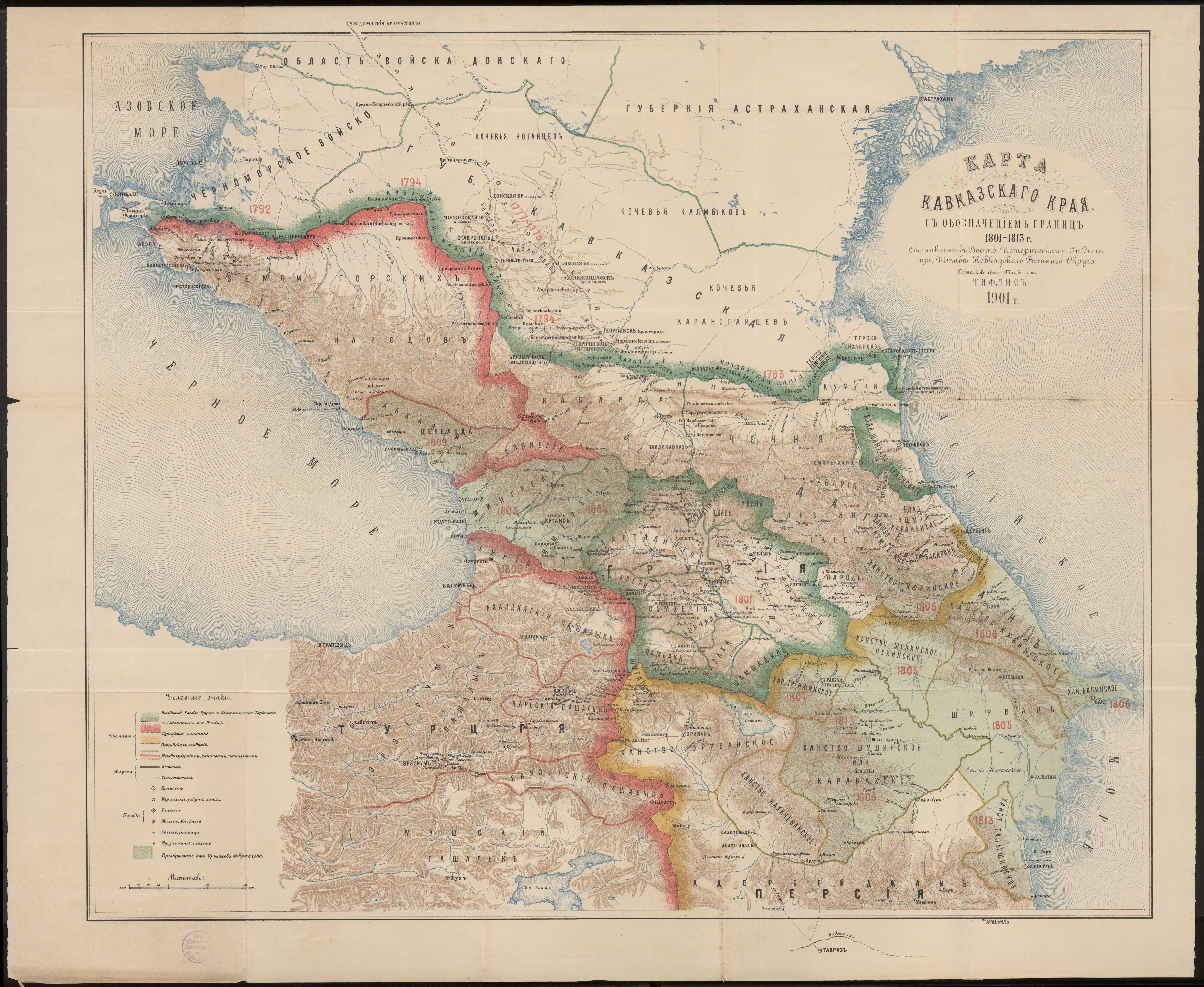
English: Khanate of Talysh in the Map of Caucasus with the borders 1801-1813 |
| Сана | |
| Манбаъ | Карта Кавказского края с обозначением границ 1801-1813 г. Составлена в военно-историческом отделе при штабе Кавказского военного округа подполковником Томкиевым. Тифлис 1901 г. |
| Муаллиф | Томкиев |
|
This work is in the public domain in its country of origin and other countries and areas where the copyright term is the author's life plus 70 years or fewer.
| |
| This file has been identified as being free of known restrictions under copyright law, including all related and neighboring rights. | |
Таърихи файл
Рӯи таърихҳо клик кунед то нусхаи марбути парвандаро бубинед.
| Таърих | Бандангуштӣ | Андоза | Корбар | Тавзеҳ | |
|---|---|---|---|---|---|
| нусхаи феълӣ | 18:09, 13 сентябри 2012 | | 488 × 558 (528 кбайт) | Interfase | cut |
| 18:07, 13 сентябри 2012 |  | 488 × 591 (431 кбайт) | Interfase | {{Information |Description ={{en|1=Khanate of Talysh in the Map of Caucasus with the borders 1801-1813}} |Source =[http://xn--b1aaibpv0aet4h1a.xn--p1ai/forums/uploads/gallery/album_19/gallery_4_19_4287845.jpg Карта Кавказског... |
Пайвандҳо
Саҳифаҳои зерин ба ин акс пайванданд:
Истифодаи саросарии парванда
Викиҳои дигари зерин ин файлро истифода мекунанд:
- Истифода дар azb.wikipedia.org
- Истифода дар az.wikipedia.org
- Истифода дар de.wikipedia.org
- Истифода дар et.wikipedia.org
- Истифода дар fa.wikipedia.org
- Истифода дар it.wikipedia.org
- Истифода дар ka.wikipedia.org
- Истифода дар ru.wikipedia.org
- Истифода дар tr.wikipedia.org