Акс:Mughal1700.png
Андозаи ин пешнамоиш: 800 × 467 пиксел. Дигар кайфиятҳо: 320 × 187 пиксел | 640 × 374 пиксел | 1 284 × 750 пиксел.
Акси аслӣ ((1 284 × 750 пиксел, ҳаҷми парванда: 36 кбайт, навъи MIME: image/png))
Being a Ruler is a tough thing with such a vast empire
Хулоса
| Тавсифот |
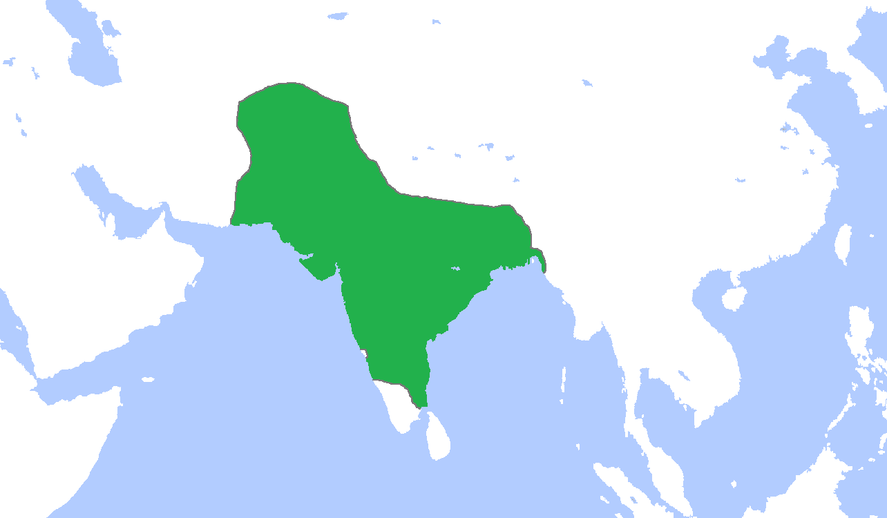
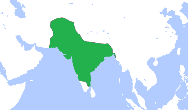
English: Locator map of the Mughal Empire, c. 1700.
(Partially based on Atlas of World History (2007) - The World 1600-1700, map) |
| Сана | |
| Манбаъ | Кори худ |
| Муаллиф | Gabagool |

|
File:MughalEmpire1700.svg is a vector version of this file. It should be used in place of this PNG file when not inferior.
File:Mughal1700.png → File:MughalEmpire1700.svg
For more information, see Help:SVG. |
 |
Иҷозатнома
I, the copyright holder of this work, hereby publish it under the following license:
This file is licensed under the Creative Commons Attribution 3.0 Unported license.
- Шумо озодед:
- мубодилот намудан – копӣ, паҳн ва фиристадани асар
- ремикс кардан – татбиқи кор
- Under the following conditions:
- тахсис – You must give appropriate credit, provide a link to the license, and indicate if changes were made. You may do so in any reasonable manner, but not in any way that suggests the licensor endorses you or your use.
Таърихи файл
Рӯи таърихҳо клик кунед то нусхаи марбути парвандаро бубинед.
| Таърих | Бандангуштӣ | Андоза | Корбар | Тавзеҳ | |
|---|---|---|---|---|---|
| нусхаи феълӣ | 16:44, 5 ноябри 2009 | | 1 284 × 750 (36 кбайт) | Gabagool | {{Information |Description={{en|1=Locator map of the Mughal Empire, c. 1700. (Partially based on ''Atlas of World History'' (2007) - The World 1600-1700, map)}} |Source={{own}} |Author=Gabagool / Jarle Grøhn |Date=2009-11-05 |Permissio |
Пайвандҳо
Саҳифаҳои зерин ба ин акс пайванданд:
Истифодаи саросарии парванда
Викиҳои дигари зерин ин файлро истифода мекунанд:
- Истифода дар ar.wikipedia.org
- Истифода дар azb.wikipedia.org
- Истифода дар bn.wikipedia.org
- Истифода дар bs.wikipedia.org
- Истифода дар crh.wikipedia.org
- Истифода дар cs.wikipedia.org
- Истифода дар cy.wikipedia.org
- Истифода дар da.wikipedia.org
- Истифода дар el.wikipedia.org
- Истифода дар en.wikipedia.org
- Истифода дар es.wikipedia.org
- Истифода дар et.wikipedia.org
- Истифода дар fa.wikipedia.org
- Истифода дар fi.wikipedia.org
- Истифода дар gu.wikipedia.org
- Истифода дар hi.wikipedia.org
- Истифода дар hu.wikipedia.org
- Истифода дар id.wikipedia.org
- Истифода дар id.wikibooks.org
- Истифода дар it.wikipedia.org
- Истифода дар ja.wikipedia.org
View more global usage of this file.