Акс:Naama Bay R01.jpg

Андозаи ин пешнамоиш: 800 × 531 пиксел. Дигар кайфиятҳо: 320 × 213 пиксел | 640 × 425 пиксел | 1 024 × 680 пиксел | 1 280 × 850 пиксел | 2 560 × 1 700 пиксел | 3 216 × 2 136 пиксел.
Акси аслӣ ((3 216 × 2 136 пиксел, ҳаҷми парванда: 5,56 Мбайт, навъи MIME: image/jpeg))
Хулоса
| Тавсифот |
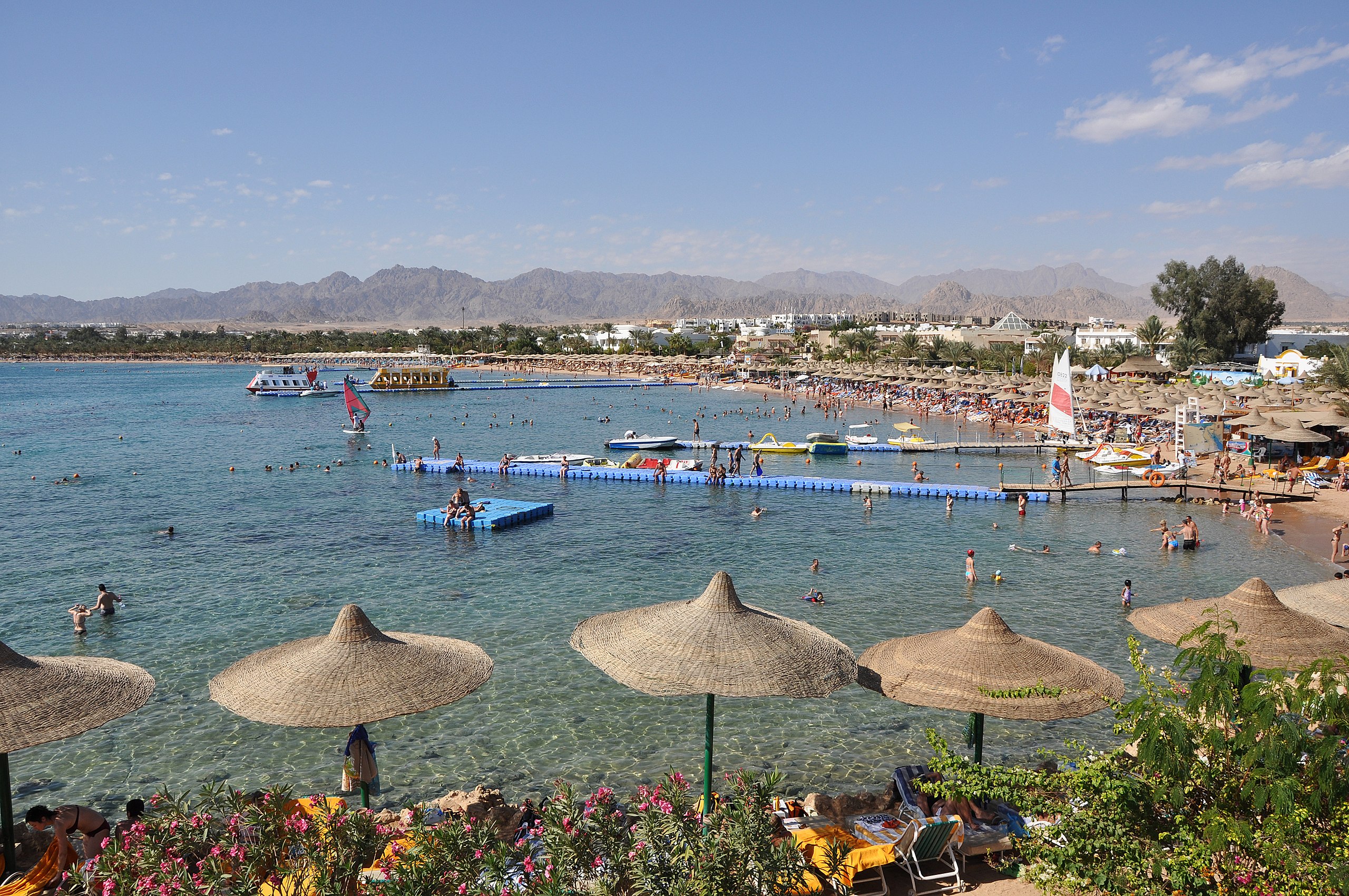
English: Sharm el-Sheikh (Egypt): panorama of Naama Bay
Nederlands: Sharm el-Sheikh (Egypte): panorama van Naama Bay
Français : Sharm el-Sheikh (Egypte): vue panoramique de Naama Bay |
| Сана | |
| Манбаъ | Кори худ |
| Муаллиф | Marc Ryckaert |
| Иҷозат (Пешроҳандозии ин парванда) |
Please attribute the author/ Naamsvermelding vereist |
| Camera location | | View this and other nearby images on: OpenStreetMap |
|---|
Иҷозатнома
I, the copyright holder of this work, hereby publish it under the following license:
This file is licensed under the Creative Commons Attribution 3.0 Unported license.
- Шумо озодед:
- мубодилот намудан – копӣ, паҳн ва фиристадани асар
- ремикс кардан – татбиқи кор
- Under the following conditions:
- тахсис – You must give appropriate credit, provide a link to the license, and indicate if changes were made. You may do so in any reasonable manner, but not in any way that suggests the licensor endorses you or your use.
This image has been assessed using the Quality image guidelines and is considered a Quality image.
|
Таърихи файл
Рӯи таърихҳо клик кунед то нусхаи марбути парвандаро бубинед.
| Таърих | Бандангуштӣ | Андоза | Корбар | Тавзеҳ | |
|---|---|---|---|---|---|
| нусхаи феълӣ | 21:08, 26 Декабри 2009 | | 3 216 × 2 136 (5,56 Мбайт) | MJJR | {{Information |Description={{en|1=Sharm el-Sheikh (Egypt): panorama of Naama Bay}} {{nl|1=Sharm el-Sheikh (Egypte): panorama van Naama Bay}} {{fr|1=Sharm el-Sheikh (Egypte): vue panoramique de Naama Bay}} |Source=Own work |Author=Marc Ryckaert ([[User:MJJ |
Пайвандҳо
Саҳифаҳои зерин ба ин акс пайванданд:
Истифодаи саросарии парванда
Викиҳои дигари зерин ин файлро истифода мекунанд:
- Истифода дар ar.wikipedia.org
- Истифода дар arz.wikipedia.org
- Истифода дар ast.wikipedia.org
- Истифода дар av.wikipedia.org
- Истифода дар azb.wikipedia.org
- Истифода дар az.wikipedia.org
- Истифода дар ba.wikipedia.org
- Истифода дар bg.wikipedia.org
- Истифода дар ca.wikipedia.org
- Истифода дар ceb.wikipedia.org
- Истифода дар ce.wikipedia.org
- Истифода дар da.wikipedia.org
- Истифода дар de.wikinews.org
- Истифода дар de.wikivoyage.org
- Истифода дар el.wikipedia.org
- Истифода дар en.wikipedia.org
- Истифода дар en.wikivoyage.org
- Истифода дар eo.wikipedia.org
- Истифода дар es.wikipedia.org
- Истифода дар eu.wikipedia.org
- Истифода дар fa.wikipedia.org
- Истифода дар fr.wikipedia.org
- Истифода дар fr.wikivoyage.org
- Истифода дар ga.wikipedia.org
- Истифода дар he.wikipedia.org
- Истифода дар he.wikivoyage.org
- Истифода дар hr.wikipedia.org
- Истифода дар hu.wikipedia.org
- Истифода дар hy.wikipedia.org
- Истифода дар ig.wikipedia.org
View more global usage of this file.