Акс:West Germany 1956-1990.svg

Ҳаҷми пешнамоиши PNG барои файли кунунии SVG: 450 × 456 пиксел. Дигар кайфиятҳо: 237 × 240 пиксел | 474 × 480 пиксел | 758 × 768 пиксел | 1 011 × 1 024 пиксел | 2 021 × 2 048 пиксел.
Акси аслӣ (SVG парванда, исмӣ 450 × 456 пиксел, андозаи парванда: 471 кбайт)
Хулоса


.svg)
.svg)
.svg)
.svg)
.svg)


.svg)
.svg)
.svg)


.png)
.png)


.svg)


.svg)

.svg)


.svg)
.svg)
.svg)
.svg)


.svg)
.png)


.svg)


.svg)
.svg)


.svg)


.svg)


.svg)
.svg)
.svg)
.svg)
.svg)
.svg)
.svg)
_cropped.svg)
.svg)
.svg)
.svg)
.svg)
.svg)
.svg)
.svg)
.svg)
.svg)
.svg)
.svg)
.svg)
.svg)
.svg)
.svg)
.svg)
.svg)
.svg)
.svg)
.svg)
.svg)
.svg)
.svg)
.svg)
.svg)
.svg)
.svg)
.svg)
.svg)
.svg)
.svg)
.svg)
.svg)
.svg)
.svg)
.svg)
.svg)
.svg)
.svg)
.svg)
.svg)
.svg)
.svg)
.svg)
.svg)
| This is a retouched picture, which means that it has been digitally altered from its original version. The original can be viewed here: Blank map of Europe 1956-1990.svg:
|
Иҷозатнома
I, the copyright holder of this work, hereby publish it under the following license:
This file is licensed under the Creative Commons Attribution-Share Alike 3.0 Unported license.
- Шумо озодед:
- мубодилот намудан – копӣ, паҳн ва фиристадани асар
- ремикс кардан – татбиқи кор
- Under the following conditions:
- тахсис – You must give appropriate credit, provide a link to the license, and indicate if changes were made. You may do so in any reasonable manner, but not in any way that suggests the licensor endorses you or your use.
- саҳми яксон – If you remix, transform, or build upon the material, you must distribute your contributions under the same or compatible license as the original.
Original upload log
This image is a derivative work of the following images:
- File:Blank_map_of_Europe_1956-1990.svg licensed with Cc-by-sa-3.0
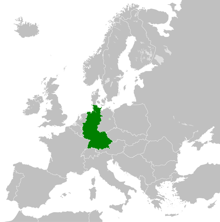
- 2011-10-30T04:43:42Z Alphathon 450x456 (485146 Bytes) == {{int:filedesc}} == {{Information |Description={{en|Blank map of Europe showing national borders as they stood from 1956-1990.}} |Source=*[[:File:Blank_map_of_Europe.svg|]] |Date=2011-10-30 04:42 (UTC) |Author=*[[:File:Bla
Таърихи файл
Рӯи таърихҳо клик кунед то нусхаи марбути парвандаро бубинед.
| Таърих | Бандангуштӣ | Андоза | Корбар | Тавзеҳ | |
|---|---|---|---|---|---|
| нусхаи феълӣ | 01:31, 28 сентябри 2018 | | 450 × 456 (471 кбайт) | FelipeRev | Se incluye Berlín Oeste pero con un color diferente, para marcar que pertenecía a su espacio económico |
| 04:04, 15 июли 2015 |  | 450 × 456 (476 кбайт) | Elevatorrailfan | Breaking apart West Germany and West Berlin paths. | |
| 01:43, 10 Декабри 2014 |  | 450 × 456 (476 кбайт) | Elevatorrailfan | West Berlin was not part of West Germany. | |
| 00:39, 26 ноябри 2011 |  | 450 × 456 (474 кбайт) | StalwartUK | == {{int:filedesc}} == {{Information |Description={{en|Map of West Germany (Federal Republic of Germany) as it was from 1949-1990. Surrounding countries accurate from 1956-1990.}} |Source=*[[:File:Blank_map_of_Europe_1956-1990.svg|Bla |
Пайвандҳо
Саҳифаҳои зерин ба ин акс пайванданд:
Истифодаи саросарии парванда
Викиҳои дигари зерин ин файлро истифода мекунанд:
- Истифода дар af.wikipedia.org
- Истифода дар an.wikipedia.org
- Истифода дар ar.wikipedia.org
- Истифода дар ast.wikipedia.org
- Истифода дар be.wikipedia.org
- Истифода дар bn.wikipedia.org
- Истифода дар bs.wikipedia.org
- Истифода дар ca.wikipedia.org
- Истифода дар cs.wikipedia.org
- Истифода дар da.wikipedia.org
- Истифода дар el.wikipedia.org
- Истифода дар en.wikipedia.org
- Истифода дар eo.wikipedia.org
- Истифода дар es.wikipedia.org
- Истифода дар eu.wikipedia.org
- Истифода дар fi.wikipedia.org
- Истифода дар fr.wikipedia.org
- Истифода дар fr.wiktionary.org
- Истифода дар ga.wikipedia.org
- Истифода дар gl.wikipedia.org
- Истифода дар gv.wikipedia.org
- Истифода дар ha.wikipedia.org
- Истифода дар he.wikipedia.org
- Истифода дар hi.wikipedia.org
- Истифода дар hr.wikipedia.org
- Истифода дар ia.wikipedia.org
- Истифода дар id.wikipedia.org
- Истифода дар io.wikipedia.org
- Истифода дар it.wikipedia.org
- Истифода дар ja.wikipedia.org
- Истифода дар ka.wikipedia.org
- Истифода дар ko.wikipedia.org
- Истифода дар ku.wikipedia.org
- Истифода дар lij.wikipedia.org
- Истифода дар lld.wikipedia.org
- Истифода дар lmo.wikipedia.org
- Истифода дар lt.wikipedia.org
- Истифода дар lv.wikipedia.org
- Истифода дар mk.wikipedia.org
- Истифода дар ml.wikipedia.org
- Истифода дар mr.wikipedia.org
- Истифода дар ms.wikipedia.org
View more global usage of this file.