Акс:Akagiyama ono.jpg
Андозаи ин пешнамоиш: 800 × 600 пиксел. Дигар кайфиятҳо: 320 × 240 пиксел | 640 × 480 пиксел | 1 024 × 768 пиксел | 1 280 × 960 пиксел | 2 592 × 1 944 пиксел.
Акси аслӣ ((2 592 × 1 944 пиксел, ҳаҷми парванда: 1,51 Мбайт, навъи MIME: image/jpeg))
Хулоса
| Тавсифот |
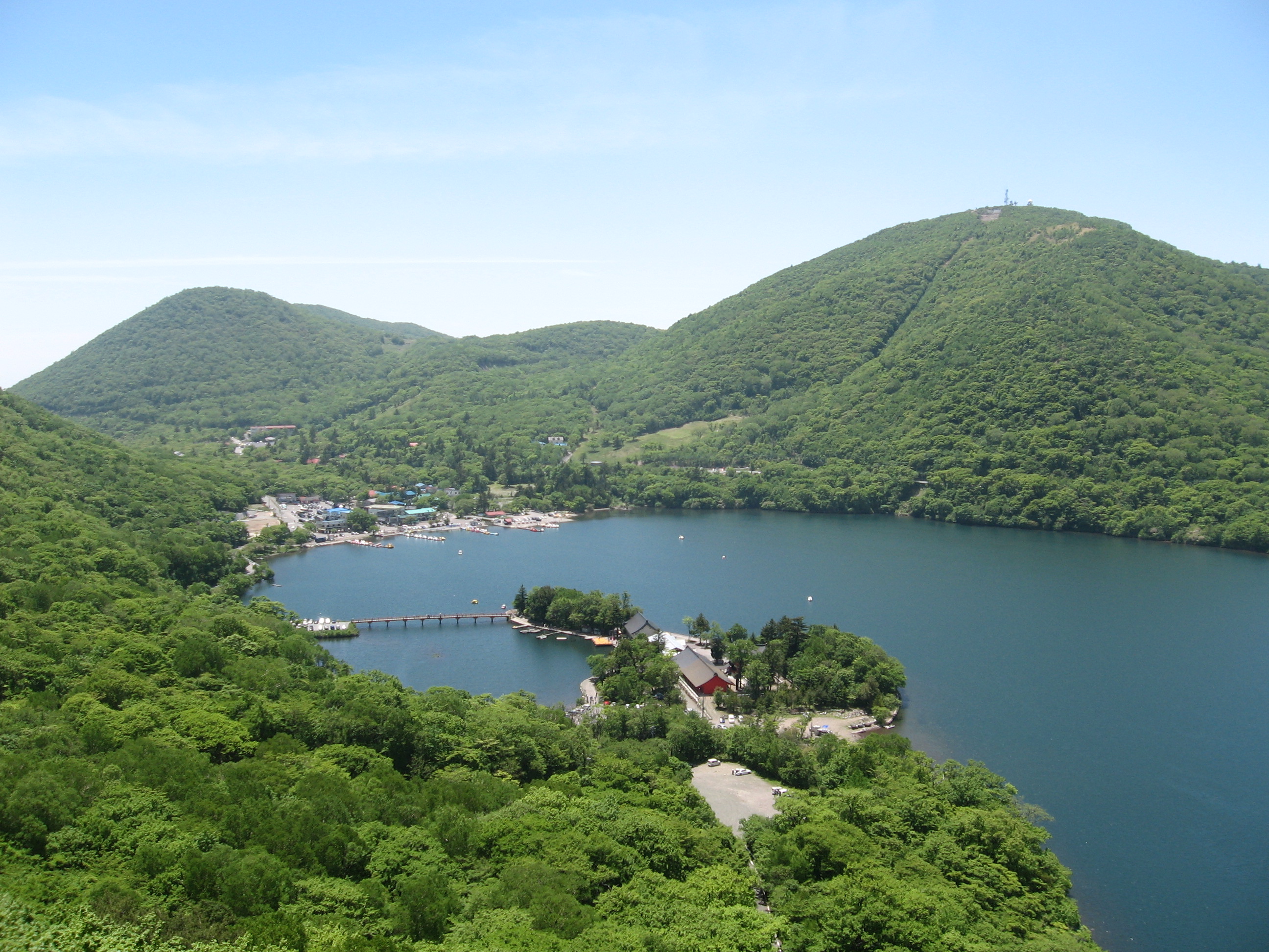
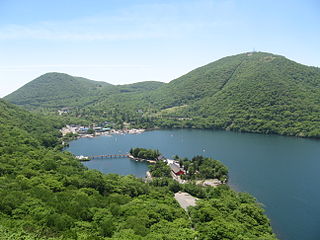
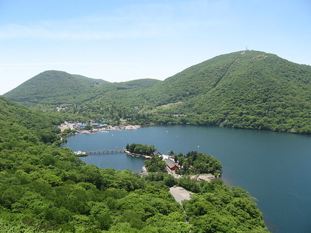
English: Lake Ono and Akagi shrine in Mount Akagi |
| Сана | |
| Манбаъ | Кори худ |
| Муаллиф | Uraomote yamaneko |
| Camera location | | View this and other nearby images on: OpenStreetMap |
|---|
Иҷозатнома
I, the copyright holder of this work, hereby publish it under the following licenses:

|
Permission is granted to copy, distribute and/or modify this document under the terms of the GNU Free Documentation License, Version 1.2 or any later version published by the Free Software Foundation; with no Invariant Sections, no Front-Cover Texts, and no Back-Cover Texts. A copy of the license is included in the section entitled GNU Free Documentation License. |
This file is licensed under the Creative Commons Attribution-Share Alike 3.0 Unported, 2.5 Generic, 2.0 Generic and 1.0 Generic license.
- Шумо озодед:
- мубодилот намудан – копӣ, паҳн ва фиристадани асар
- ремикс кардан – татбиқи кор
- Under the following conditions:
- тахсис – You must give appropriate credit, provide a link to the license, and indicate if changes were made. You may do so in any reasonable manner, but not in any way that suggests the licensor endorses you or your use.
- саҳми яксон – If you remix, transform, or build upon the material, you must distribute your contributions under the same or compatible license as the original.
Шумо иҷозатномаи хостаи худро интихоб карда метавонед.
| Annotations | This image is annotated: View the annotations at Commons |
Таърихи файл
Рӯи таърихҳо клик кунед то нусхаи марбути парвандаро бубинед.
| Таърих | Бандангуштӣ | Андоза | Корбар | Тавзеҳ | |
|---|---|---|---|---|---|
| нусхаи феълӣ | 06:57, 24 сентябри 2007 | | 2 592 × 1 944 (1,51 Мбайт) | Uraomote yamaneko | {{Information |Description={{en|Lake Ono and Akagi shrine in Mount Akagi}}{{ja|赤城山の大沼(おの)と赤城神社}} |Source=self-made |Date=2007-06-17 |Author=uraomote_yamaneko |Permission= |other_versions= }} |
Пайвандҳо
Саҳифаҳои зерин ба ин акс пайванданд:
Истифодаи саросарии парванда
Викиҳои дигари зерин ин файлро истифода мекунанд:
- Истифода дар ar.wikipedia.org
- Истифода дар ca.wikipedia.org
- Истифода дар ceb.wikipedia.org
- Истифода дар ce.wikipedia.org
- Истифода дар cs.wikipedia.org
- Истифода дар cy.wikipedia.org
- Истифода дар da.wikipedia.org
- Истифода дар de.wikipedia.org
- Истифода дар de.wikivoyage.org
- Истифода дар en.wikipedia.org
- Истифода дар es.wikipedia.org
- Истифода дар eu.wikipedia.org
- Истифода дар fr.wikivoyage.org
- Истифода дар ga.wikipedia.org
- Истифода дар gl.wikipedia.org
- Истифода дар he.wikipedia.org
- Истифода дар hu.wikipedia.org
- Истифода дар hy.wikipedia.org
- Истифода дар incubator.wikimedia.org
- Истифода дар ja.wikipedia.org
- Истифода дар ja.wikivoyage.org
- Истифода дар ka.wikipedia.org
- Истифода дар ko.wikipedia.org
- Истифода дар no.wikipedia.org
- Истифода дар os.wikipedia.org
- Истифода дар pl.wikipedia.org
- Истифода дар pt.wikipedia.org
- Истифода дар ro.wikipedia.org
View more global usage of this file.