Акс:Andorra relief location map.jpg

Андозаи ин пешнамоиш: 683 × 599 пиксел. Дигар кайфиятҳо: 274 × 240 пиксел | 547 × 480 пиксел | 875 × 768 пиксел | 1 161 × 1 019 пиксел.
Акси аслӣ ((1 161 × 1 019 пиксел, ҳаҷми парванда: 220 кбайт, навъи MIME: image/jpeg))
Хулоса
| Тавсифот |
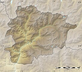
English: Blank physical map of Andorra with parishes boundaries for geo-location purpose.
Note: Dotted lines are boundaries estimated from very small scale reference maps. Français : Carte physique vierge de l'Andorre avec limites des paroisses destinée à la géolocalisation. Note : les lignes pointillées sont des limites estimées à partir de cartes de référence à très petite échelle. Equirectangular projection, WGS84 datum
Topographic scale: 1:372,000 (precision: 93 m)
|
||
| Сана | |||
| Манбаъ |
Own work |
||
| Муаллиф | Eric Gaba (Sting - fr:Sting) | ||
| Иҷозат (Пешроҳандозии ин парванда) |
|
||
| Other versions |
|

| Camera location | | View this and other nearby images on: OpenStreetMap |
|---|
Иҷозатнома
I, the copyright holder of this work, hereby publish it under the following licenses:
This file is licensed under the Creative Commons Attribution-Share Alike 3.0 Unported license.
- Шумо озодед:
- мубодилот намудан – копӣ, паҳн ва фиристадани асар
- ремикс кардан – татбиқи кор
- Under the following conditions:
- тахсис – You must give appropriate credit, provide a link to the license, and indicate if changes were made. You may do so in any reasonable manner, but not in any way that suggests the licensor endorses you or your use.
- саҳми яксон – If you remix, transform, or build upon the material, you must distribute your contributions under the same or compatible license as the original.

|
Permission is granted to copy, distribute and/or modify this document under the terms of the GNU Free Documentation License, Version 1.2 or any later version published by the Free Software Foundation; with no Invariant Sections, no Front-Cover Texts, and no Back-Cover Texts. A copy of the license is included in the section entitled GNU Free Documentation License. |
Шумо иҷозатномаи хостаи худро интихоб карда метавонед.
Таърихи файл
Рӯи таърихҳо клик кунед то нусхаи марбути парвандаро бубинед.
| Таърих | Бандангуштӣ | Андоза | Корбар | Тавзеҳ | |
|---|---|---|---|---|---|
| нусхаи феълӣ | 20:52, 27 Декабри 2010 | | 1 161 × 1 019 (220 кбайт) | Sting | Added parishes boundaries (some of them estimated) |
| 12:09, 19 июли 2010 |  | 1 161 × 1 019 (212 кбайт) | Sting | Color profile | |
| 20:04, 17 Декабри 2008 |  | 1 161 × 1 019 (181 кбайт) | Sting | Corrections on international boundaries | |
| 20:20, 16 Декабри 2008 |  | 1 161 × 1 019 (189 кбайт) | Sting | == Summary == {{Location|42|32|15|N|01|36|00|E|scale:200000}} <br/> {{Information |Description={{en|Blank physical map of Andorra for geo-location purpose.}} {{fr|Carte physique vierge de l'Andorre destinée à la géolocal |
Пайвандҳо
Саҳифаҳои зерин ба ин акс пайванданд:
Истифодаи саросарии парванда
Викиҳои дигари зерин ин файлро истифода мекунанд:
- Истифода дар ar.wikipedia.org
- Истифода дар ast.wikipedia.org
- Истифода дар av.wikipedia.org
- Истифода дар az.wikipedia.org
- Истифода дар ba.wikipedia.org
- Истифода дар be-tarask.wikipedia.org
- Истифода дар be.wikipedia.org
- Истифода дар bg.wikipedia.org
- Истифода дар bn.wikipedia.org
- Истифода дар bs.wikipedia.org
- Истифода дар ca.wikipedia.org
- Usuari:PereBot/cobertura/Andorra relleu/ranking
- Usuari:PereBot/cobertura/Andorra relleu/an
- Usuari:PereBot/cobertura/Andorra relleu/ca
- Usuari:PereBot/cobertura/Andorra relleu/de
- Usuari:PereBot/cobertura/Andorra relleu/en
- Usuari:PereBot/cobertura/Andorra relleu/es
- Usuari:PereBot/cobertura/Andorra relleu/eu
- Usuari:PereBot/cobertura/Andorra relleu/fr
- Usuari:PereBot/cobertura/Andorra relleu/nl
- Usuari:PereBot/cobertura/Andorra relleu/it
- Usuari:PereBot/cobertura/Andorra relleu/oc
- Usuari:PereBot/cobertura/Andorra relleu/zh
- Usuari Discussió:Lanxana
- Mòdul:Location map/data/Andorra
- Mòdul:Location map/data/Andorra/ús
- Истифода дар ceb.wikipedia.org
- Истифода дар ce.wikipedia.org
- Истифода дар ckb.wikipedia.org
- Истифода дар cs.wikipedia.org
- Истифода дар cv.wikipedia.org
- Истифода дар da.wikipedia.org
- Истифода дар de.wikipedia.org
View more global usage of this file.