Акс:England south location map.svg

Ҳаҷми пешнамоиши PNG барои файли кунунии SVG: 800 × 485 пиксел. Дигар кайфиятҳо: 320 × 194 пиксел | 640 × 388 пиксел | 1 024 × 621 пиксел | 1 280 × 776 пиксел | 2 560 × 1 553 пиксел | 816 × 495 пиксел.
Акси аслӣ (SVG парванда, исмӣ 816 × 495 пиксел, андозаи парванда: 460 кбайт)
Хулоса
| Тавсифот |
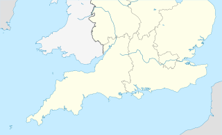
English: Map of Southern England (also showing portions of Wales, Ireland and France)
Equirectangular projection, N/S stretching 170 %. Geographic limits of the map:
|
| Сана | |
| Манбаъ | File:England location map.svg |
| Муаллиф | NordNordWest |
| This is a retouched picture, which means that it has been digitally altered from its original version. The original can be viewed here: England location map.svg:
|
Иҷозатнома
This file is licensed under the Creative Commons Attribution-Share Alike 3.0 Unported license.
- Шумо озодед:
- мубодилот намудан – копӣ, паҳн ва фиристадани асар
- ремикс кардан – татбиқи кор
- Under the following conditions:
- тахсис – You must give appropriate credit, provide a link to the license, and indicate if changes were made. You may do so in any reasonable manner, but not in any way that suggests the licensor endorses you or your use.
- саҳми яксон – If you remix, transform, or build upon the material, you must distribute your contributions under the same or compatible license as the original.
Таърихи файл
Рӯи таърихҳо клик кунед то нусхаи марбути парвандаро бубинед.
| Таърих | Бандангуштӣ | Андоза | Корбар | Тавзеҳ | |
|---|---|---|---|---|---|
| нусхаи феълӣ | 11:17, 29 марти 2012 | | 816 × 495 (460 кбайт) | Wikidwitch |
Пайвандҳо
Саҳифаҳои зерин ба ин акс пайванданд:
Истифодаи саросарии парванда
Викиҳои дигари зерин ин файлро истифода мекунанд:
- Истифода дар ar.wikipedia.org
- Истифода дар bs.wikipedia.org
- Истифода дар ceb.wikipedia.org
- Истифода дар ckb.wikipedia.org
- Истифода дар da.wikipedia.org
- Истифода дар el.wikipedia.org
- Истифода дар en.wikipedia.org
- Glorious Revolution
- Gatwick Airport
- Denzil Holles, 1st Baron Holles
- William Waller
- Ralph Hopton, 1st Baron Hopton
- SS Mendi
- British Rail Class 52
- Southern Football League
- British Rail Class 15
- British Rail Class 16
- National League South
- Wessex Football League
- Cranfield University
- Device Forts
- First English Civil War
- First Battle of Newbury
- Adrian Scrope
- British Rail Class 43 (Warship Class)
- FA Women's National League South
- British Rail Class 33
- British Rail Class 35
- British Rail Class 22
- Grim's Ditch
- Pontins
- Robert Greville, 2nd Baron Brooke
- Allen Apsley (Royalist)
- John/Eleanor Rykener
- Sir Richard Browne, 1st Baronet, of London
- George Lisle (Royalist)
- Football at the 1948 Summer Olympics
- 2006–07 Southern Football League
- User:One Salient Oversight/sandbox
- Thomas Blagge
- 2007–08 Southern Football League
- British Universities American Football League
- 2008–09 Southern Football League
- User:Wikidwitch/sandbox
- Storming of Bristol
- 2007–08 National Division Three South
- 2008–09 National Division Three South
- 2009–10 Southern Football League
- Southern Counties North
- National League 2 South
- South West 1 East
View more global usage of this file.