Акс:Europe relief laea location map.jpg

Андозаи ин пешнамоиш: 701 × 599 пиксел. Дигар кайфиятҳо: 281 × 240 пиксел | 561 × 480 пиксел | 898 × 768 пиксел | 1 198 × 1 024 пиксел | 1 580 × 1 351 пиксел.
Акси аслӣ ((1 580 × 1 351 пиксел, ҳаҷми парванда: 1,1 Мбайт, навъи MIME: image/jpeg))
India
Хулоса
| Тавсифот |
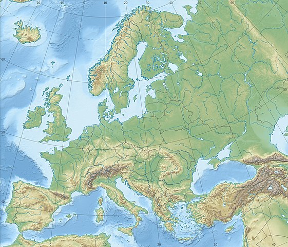
Deutsch: Physische Positionskarte Europa; Flächentreue Azimutalprojektion
English: Physical location map Europe; Lambert azimuthal equal-area projection
|
| Сана | |
| Манбаъ |
Кори худ
|
| Муаллиф | Alexrk2 |
| Other versions |
Derivative works of this file:
[]
|


.svg)


_ru.svg)

|
This map has been made or improved in the German Kartenwerkstatt (Map Lab). You can propose maps to improve as well.
|
Иҷозатнома
I, the copyright holder of this work, hereby publish it under the following license:
This file is licensed under the Creative Commons Attribution-Share Alike 3.0 Unported license.
- Шумо озодед:
- мубодилот намудан – копӣ, паҳн ва фиристадани асар
- ремикс кардан – татбиқи кор
- Under the following conditions:
- тахсис – You must give appropriate credit, provide a link to the license, and indicate if changes were made. You may do so in any reasonable manner, but not in any way that suggests the licensor endorses you or your use.
- саҳми яксон – If you remix, transform, or build upon the material, you must distribute your contributions under the same or compatible license as the original.
Таърихи файл
Рӯи таърихҳо клик кунед то нусхаи марбути парвандаро бубинед.
| Таърих | Бандангуштӣ | Андоза | Корбар | Тавзеҳ | |
|---|---|---|---|---|---|
| нусхаи феълӣ | 22:29, 4 июли 2018 | | 1 580 × 1 351 (1,1 Мбайт) | Subtropical-man | Reverted to version as of 22:56, 20 August 2012 (UTC) |
| 17:54, 2 июли 2018 |  | 1 580 × 1 351 (821 кбайт) | 1970gemini | fiat lux | |
| 22:56, 20 августи 2012 |  | 1 580 × 1 351 (1,1 Мбайт) | McZusatz | Reverted to version as of 10:53, 14 March 2010 (...thumb fixed?) | |
| 22:55, 20 августи 2012 |  | 120 × 103 (4 кбайт) | McZusatz | fixing thumb... | |
| 10:53, 14 марти 2010 |  | 1 580 × 1 351 (1,1 Мбайт) | Alexrk2 | == Summary == {{Information |Description= {{de|Physische Positionskarte Europa; Flächentreue Azimutalprojektion}} {{en|Physical location map Europe; Lambert azimuthal equal-area projection}} * Projection: LAEA Europe, [http: |
Пайвандҳо
Саҳифаҳои зерин ба ин акс пайванданд:
Истифодаи саросарии парванда
Викиҳои дигари зерин ин файлро истифода мекунанд:
- Истифода дар ab.wikipedia.org
- Истифода дар als.wikipedia.org
- Истифода дар ar.wikipedia.org
- Истифода дар arz.wikipedia.org
- Истифода дар ast.wikipedia.org
- Истифода дар av.wikipedia.org
- Истифода дар azb.wikipedia.org
- Истифода дар az.wikipedia.org
View more global usage of this file.