Акс:Relief Map of Bulgaria.jpg

Андозаи ин пешнамоиш: 800 × 505 пиксел. Дигар кайфиятҳо: 320 × 202 пиксел | 640 × 404 пиксел | 1 024 × 646 пиксел | 1 280 × 808 пиксел | 1 642 × 1 036 пиксел.
Акси аслӣ ((1 642 × 1 036 пиксел, ҳаҷми парванда: 459 кбайт, навъи MIME: image/jpeg))
Хулоса
| Тавсифот |
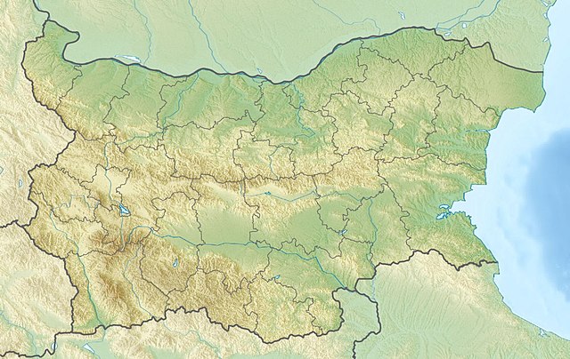
English: Location map of Bulgaria Equirectangular projection, N/S stretching 130 %. Geographic limits of the map:
|
| Сана | (UTC) |
| Манбаъ |
|
| Муаллиф |
|
| Other versions | Derivative works of this file: Relief Map of Bulgaria Burgasebene.jpg |
| This is a retouched picture, which means that it has been digitally altered from its original version. The original can be viewed here: Bulgaria location map.svg:
|
Иҷозатнома
I, the copyright holder of this work, hereby publish it under the following licenses:
This file is licensed under the Creative Commons Attribution-Share Alike 3.0 Unported license.
- Шумо озодед:
- мубодилот намудан – копӣ, паҳн ва фиристадани асар
- ремикс кардан – татбиқи кор
- Under the following conditions:
- тахсис – You must give appropriate credit, provide a link to the license, and indicate if changes were made. You may do so in any reasonable manner, but not in any way that suggests the licensor endorses you or your use.
- саҳми яксон – If you remix, transform, or build upon the material, you must distribute your contributions under the same or compatible license as the original.

|
Permission is granted to copy, distribute and/or modify this document under the terms of the GNU Free Documentation License, Version 1.2 or any later version published by the Free Software Foundation; with no Invariant Sections, no Front-Cover Texts, and no Back-Cover Texts. A copy of the license is included in the section entitled GNU Free Documentation License. |
Шумо иҷозатномаи хостаи худро интихоб карда метавонед.
Original upload log
This image is a derivative work of the following images:
- File:Bulgaria_location_map.svg licensed with Cc-by-sa-3.0, GFDL
- 2010-10-06T18:28:14Z NordNordWest 1642x1036 (282074 Bytes) upd
- 2009-08-12T18:23:52Z Пакко 1536x970 (209136 Bytes) fixed Iskar Lake
- 2009-08-03T18:12:56Z Пакко 1534x967 (211583 Bytes) fixed some borders according to current administrative division
- 2008-08-25T18:52:33Z NordNordWest 1645x1038 (304442 Bytes) size correction
- 2008-08-12T12:25:58Z NordNordWest 548x346 (298143 Bytes) corrected
- 2008-08-05T20:30:09Z NordNordWest 548x346 (296113 Bytes) {{Information |Description= {{de|Positionskarte von [[:de:Bulgarien|Bulgarien]]}} Quadratische Plattkarte, N-S-Streckung 130 %. Geographische Begrenzung der Karte: * N: 44.4° N * S: 41.1° N * W: 22.1° O * O: 28.9° O {{en|
Uploaded with derivativeFX
Таърихи файл
Рӯи таърихҳо клик кунед то нусхаи марбути парвандаро бубинед.
| Таърих | Бандангуштӣ | Андоза | Корбар | Тавзеҳ | |
|---|---|---|---|---|---|
| нусхаи феълӣ | 09:20, 3 апрели 2016 | | 1 642 × 1 036 (459 кбайт) | Pticy uleteli | унификация разрешения с административной картой для корректной работы imagemap |
| 10:26, 28 ноябри 2010 |  | 1 200 × 757 (306 кбайт) | Виктор В | {{Information |Description={{en|Location map of Bulgaria}} Equirectangular projection, N/S stretching 130 %. Geographic limits of the map: * N: 44.4° N * S: 41.1° N * W: 22.1° E * E: 28.9° E |Source=*[[:File:Bulgaria_location_map. |
Пайвандҳо
Саҳифаҳои зерин ба ин акс пайванданд:
Истифодаи саросарии парванда
Викиҳои дигари зерин ин файлро истифода мекунанд:
- Истифода дар am.wikipedia.org
- Истифода дар ar.wikipedia.org
- Истифода дар ast.wikipedia.org
- Истифода дар azb.wikipedia.org
- Истифода дар az.wikipedia.org
- Şablon:Yer xəritəsi Bolqarıstan
- Pirin Milli Parkı
- Rodop dağları
- Srebırna Təbiət Qoruğu
- Maqura mağarası
- Pirin
- Belintaş
- Balkan dağları
- Mərkəzi Balkan Milli Parkı
- Əminə burnu
- Kom dağı
- Stara-Reka qoruğu
- Bayuvi-Dupki — Cincirsa
- Uzunbucaq
- Yulen qoruğu
- Orelyak qoruğu
- Sıyeva dupka
- Buynovsk dərəsi
- Uxlovitsa mağarası
- Triqrad dərəsi
- Kamçiya qoruğu
- Ali Botuş qoruğu
- Pobiti daşları
- Torfeno Branişte
- Bistrişko Branişte
- Poda Qorunan Təbiət Ərazisi
- Beloslav gölü
- Proxodna mağarası
- Rozhen Rəsədxanası
- Истифода дар ban.wikipedia.org
- Истифода дар ba.wikipedia.org
- Истифода дар be.wikipedia.org
View more global usage of this file.