Акс:Relief Map of Lithuania.jpg

Андозаи ин пешнамоиш: 800 × 600 пиксел. Дигар кайфиятҳо: 320 × 240 пиксел | 640 × 480 пиксел | 1 024 × 768 пиксел | 1 200 × 900 пиксел.
Акси аслӣ ((1 200 × 900 пиксел, ҳаҷми парванда: 387 кбайт, навъи MIME: image/jpeg))
Хулоса
| Тавсифот |
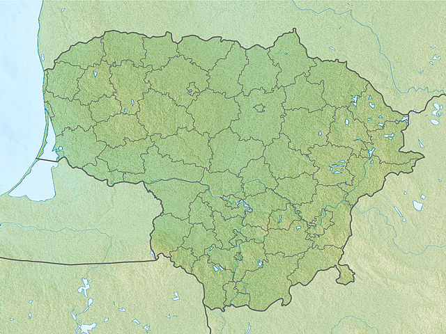
English: Location map of Lithuania Equirectangular projection, N/S stretching 170 %. Geographic limits of the map:
|
| Сана | (UTC) |
| Манбаъ | |
| Муаллиф |
|
| This is a retouched picture, which means that it has been digitally altered from its original version. The original can be viewed here: Lithuania location map.svg:
|
Иҷозатнома
I, the copyright holder of this work, hereby publish it under the following licenses:
This file is licensed under the Creative Commons Attribution-Share Alike 3.0 Unported license.
- Шумо озодед:
- мубодилот намудан – копӣ, паҳн ва фиристадани асар
- ремикс кардан – татбиқи кор
- Under the following conditions:
- тахсис – You must give appropriate credit, provide a link to the license, and indicate if changes were made. You may do so in any reasonable manner, but not in any way that suggests the licensor endorses you or your use.
- саҳми яксон – If you remix, transform, or build upon the material, you must distribute your contributions under the same or compatible license as the original.

|
Permission is granted to copy, distribute and/or modify this document under the terms of the GNU Free Documentation License, Version 1.2 or any later version published by the Free Software Foundation; with no Invariant Sections, no Front-Cover Texts, and no Back-Cover Texts. A copy of the license is included in the section entitled GNU Free Documentation License. |
Шумо иҷозатномаи хостаи худро интихоб карда метавонед.
Original upload log
This image is a derivative work of the following images:
- File:Lithuania_location_map.svg licensed with Cc-by-sa-3.0, GFDL
- 2010-03-20T22:53:54Z NordNordWest 1095x821 (111884 Bytes) update
- 2008-08-29T08:11:36Z NordNordWest 1097x822 (103917 Bytes)
- 2008-07-02T15:27:16Z NordNordWest 548x411 (126294 Bytes) {{Information |Description= {{de|Positionskarte von [[:de:Litauen|Litauen]]}} Quadratische Plattkarte, N-S-Streckung 170 %. Geographische Begrenzung der Karte: * N: 56.7° N * S: 53.7° N * W: 20.4° O * O: 27.2° O {{en|Loca
Uploaded with derivativeFX
Таърихи файл
Рӯи таърихҳо клик кунед то нусхаи марбути парвандаро бубинед.
| Таърих | Бандангуштӣ | Андоза | Корбар | Тавзеҳ | |
|---|---|---|---|---|---|
| нусхаи феълӣ | 17:34, 27 ноябри 2010 | | 1 200 × 900 (387 кбайт) | Виктор В | {{Information |Description={{en|Location map of Lithuania}} Equirectangular projection, N/S stretching 170 %. Geographic limits of the map: * N: 56.7° N * S: 53.7° N * W: 20.4° E * E: 27.2° E |Source=*[[:File:Lithuania_location_m |
Пайвандҳо
Саҳифаҳои зерин ба ин акс пайванданд:
Истифодаи саросарии парванда
Викиҳои дигари зерин ин файлро истифода мекунанд:
- Истифода дар als.wikipedia.org
- Истифода дар an.wikipedia.org
- Истифода дар ar.wikipedia.org
- Истифода дар ast.wikipedia.org
- Истифода дар azb.wikipedia.org
- Истифода дар az.wikipedia.org
- Şablon:Yer xəritəsi Litva
- Aukştaytiya Milli Parkı
- Drukşyay gölü
- Platelyay gölü
- Klaypeda Dəmiryol Stansiyası
- Rusne adası
- İqnalina AES
- Kurş dili
- Vyante burnu
- Asveya gölü
- Çepkelyay
- Vilnüs Dəmiryolu Stansiyası
- Rambinas
- Labanoras Regional Parkı
- Tituvenay regional parkı
- Tauraqnas gölü
- Trakay Tarixi Milli Parkı
- Elektrenay su anbarı
- Dzukiya Milli Parkı
- Rekiva gölü
- Истифода дар ba.wikipedia.org
- Истифода дар be.wikipedia.org
View more global usage of this file.