Акс:South Africa location map.svg

Ҳаҷми пешнамоиши PNG барои файли кунунии SVG: 699 × 599 пиксел. Дигар кайфиятҳо: 280 × 240 пиксел | 560 × 480 пиксел | 896 × 768 пиксел | 1 195 × 1 024 пиксел | 2 389 × 2 048 пиксел | 2 031 × 1 741 пиксел.
Акси аслӣ (SVG парванда, исмӣ 2 031 × 1 741 пиксел, андозаи парванда: 644 кбайт)
Хулоса
| Тавсифот |
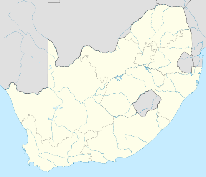
Deutsch: Positionskarte von Südafrika
Quadratische Plattkarte, N-S-Streckung 110 %. Geographische Begrenzung der Karte:
English: Location map of South Africa
Equirectangular projection, N/S stretching 110 %. Geographic limits of the map:
|
| Сана | |
| Манбаъ |
own work, using
|
| Муаллиф | NordNordWest |
| Other versions |
Derivative work: |

|
This map has been made or improved in the German Kartenwerkstatt (Map Lab). You can propose maps to improve as well.
|
Иҷозатнома
I, the copyright holder of this work, hereby publish it under the following licenses:

|
Permission is granted to copy, distribute and/or modify this document under the terms of the GNU Free Documentation License, Version 1.2 or any later version published by the Free Software Foundation; with no Invariant Sections, no Front-Cover Texts, and no Back-Cover Texts. A copy of the license is included in the section entitled GNU Free Documentation License. |
This file is licensed under the Creative Commons Attribution 3.0 Unported license.
- Шумо озодед:
- мубодилот намудан – копӣ, паҳн ва фиристадани асар
- ремикс кардан – татбиқи кор
- Under the following conditions:
- тахсис – You must give appropriate credit, provide a link to the license, and indicate if changes were made. You may do so in any reasonable manner, but not in any way that suggests the licensor endorses you or your use.
Шумо иҷозатномаи хостаи худро интихоб карда метавонед.
Таърихи файл
Рӯи таърихҳо клик кунед то нусхаи марбути парвандаро бубинед.
| Таърих | Бандангуштӣ | Андоза | Корбар | Тавзеҳ | |
|---|---|---|---|---|---|
| нусхаи феълӣ | 16:18, 28 феврали 2010 | | 2 031 × 1 741 (644 кбайт) | NordNordWest | update |
| 20:39, 25 феврали 2009 |  | 2 032 × 1 742 (654 кбайт) | NordNordWest | {{Information |Description= {{de|Positionskarte von Südafrika}} Quadratische Plattkarte, N-S-Streckung 110 %. Geographische Begrenzung der Karte: * N: 21.8° S * S: 35.2° S * W: 16.0° O * O: 33.2° O {{en|Location map of [[:en:South |
Пайвандҳо
Саҳифаҳои зерин ба ин акс пайванданд:
- Пойгоҳи Нерӯи Ҳавоии Вотерклуф
- Пойгоҳи Нерӯи Ҳавоии Дурбан
- Пойгоҳи Нерӯи Ҳавоии Йестерплат
- Пойгоҳи Нерӯи Ҳавоии Лангебаанвег
- Пойгоҳи Нерӯи Ҳавоии Махадо
- Пойгоҳи Нерӯи Ҳавоии Оверберг
- Пойгоҳи Нерӯи Ҳавоии Сварткоп
- Пойгоҳи Нерӯи Ҳавоии Ҳоедспруит
- Пойгоҳи нерӯе ҳаво блумспруит
- Пойгоҳи ҳавоии Артиши Елизабет
- Претория
- Фурудгоҳи Байналмиллалии Дурбан
- Фурудгоҳи Байналмиллалии Кинг Шака
- Фурудгоҳи Байналмиллалии Лансериа
- Фурудгоҳи Бетлеҳем
- Фурудгоҳи Блоемфонтайн
- Фурудгоҳи Йоҳан Пиенаар
- Фурудгоҳи аликсондир бе
- Фурудгоҳи байналмиллалии Кругер Мпамаланга
- Фурудгоҳи биналмилалӣ овлюр томбу
- Фурудгоҳи биналмилалӣ проеҳио
- Фурудгоҳи гарӣтун
- Фурудгоҳи грнд оснтрл
- Фурудгоҳи к.д. монтонзимо
- Фурудгоҳи кимбрли
- Фурудгоҳи клинзи
- Фурудгоҳи лидисмит
- Фурудгоҳи огнис
- Фурудгоҳи оист лондан
- Фурудгоҳи омсдол
- Фурудгоҳи рондн
- Фурудгоҳи шаҳре ҷурҷ баст блфост
- Фурудгоҳи ҳиршимо-неш
- Фурудгоҳи ҳндрик фон ок
- Шаблон:Location map South Africa
- Шаблон:ХМ Ҷумҳурии Африқои Ҷанубӣ
Истифодаи саросарии парванда
Викиҳои дигари зерин ин файлро истифода мекунанд:
- Истифода дар af.wikipedia.org
- Mapungubwe
- Oranjerivier
- Tafelberg
- Duiwelspiek
- Hartsrivier
- Kaapse floraryk
- Sjabloon:Inligtingskas Berg
- Roggeveldberge
- Nasionale Vrouemonument
- Mont-aux-Sources
- Olifantsrivier, Limpopo
- Toorberg (berg)
- Wieg van die Mensdom
- Sjabloon:Inligtingskas Wêrelderfenisgebied
- Richtersveld
- Sterkfontein
- Sjabloon:Liggingkaart Suid-Afrika
- Grassridgedam
- Sondagsrivier
- Klein-Visrivier
- Seweweekspoortpiek
- Kompasberg
- Thabana Ntlenyana
- Die Berg
- Kwaduma
- Ben Macdhui
- Sneeuberg
- Matroosberg
- Bloukranspas
- Moloporivier
- Modderrivier
- Kranskop (koppie)
- Kliprivier, Vrystaat/Mpumalanga grens
- Kliprivier, Gauteng
- Kliprivier, KwaZulu-Natal
- Wilgerivier (Vaal)
- Majubaberg
- Groot-Keirivier
- Keiskammarivier
- Leeukop
- Seinheuwel
- Soutkop
- Mokala- Nasionale Park
- Rooinekpas
- Nonesisnek
- Oudebergpas
- Pitsengpas
- Potrivierpas
- Krokodilrivier (Limpopo)
- Krokodilrivier (Mpumalanga)
View more global usage of this file.